By Korin
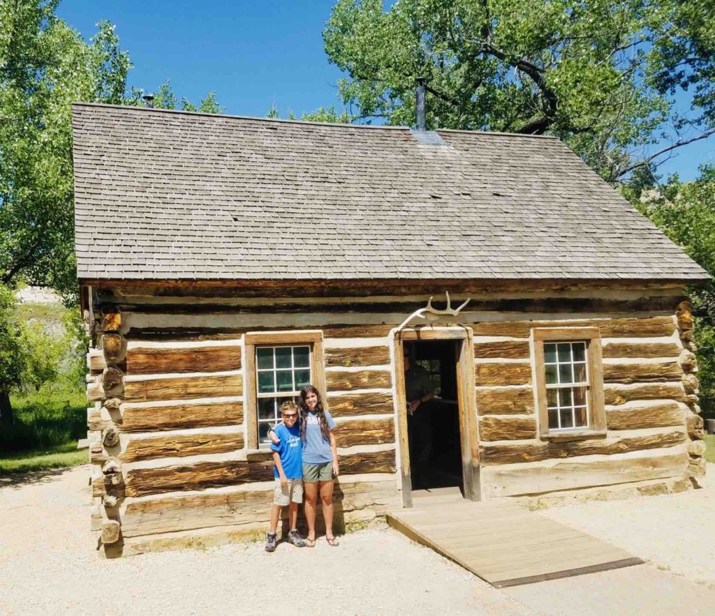
I wanted to visit Theodore Roosevelt National Park last summer but we just couldn’t squeeze it into our trip. From everything I had researched, I thought the park would be similar to Badlands National Park and in some ways, it was. The park is divided up into three sections: North Unit, Elkhorn Ranch, South Unit. We arrived in the south unit and headed straight for the visitor’s center. We watched the park movie, went through the museum, and took a tour of Roosevelt’s Maltese Cross Cabin. We learned that Theodore Roosevelt came to the North Dakota Badlands in 1883 to hunt buffalo (bison). During his first trip he shot a buffalo, bought into a ranch, and entered the cattle business. He returned to New York, but headed back to the Badlands in 1884 to grieve and find solitude after his wife and mother died on the same day. During his presidency, Roosevelt credited his time in North Dakota as inspiring his later wilderness preservation efforts within the United States.
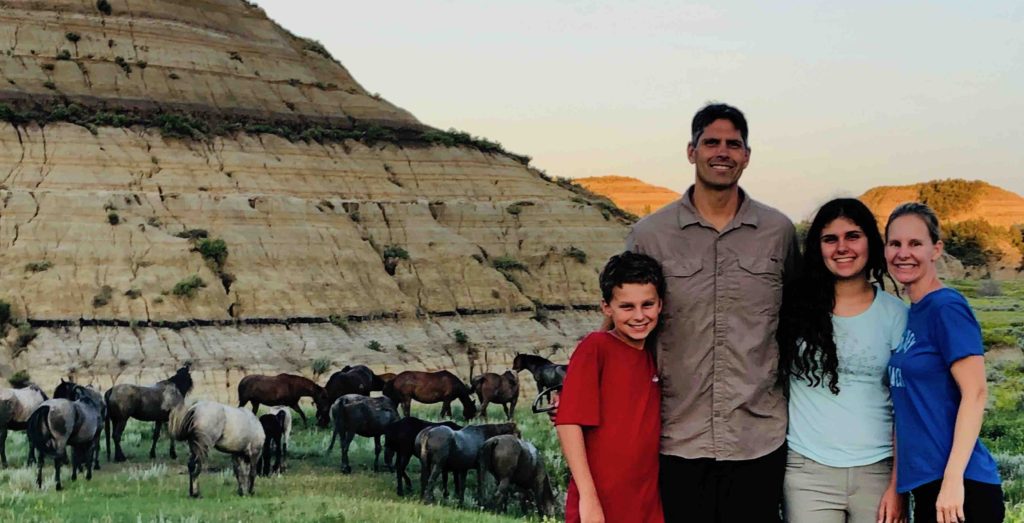
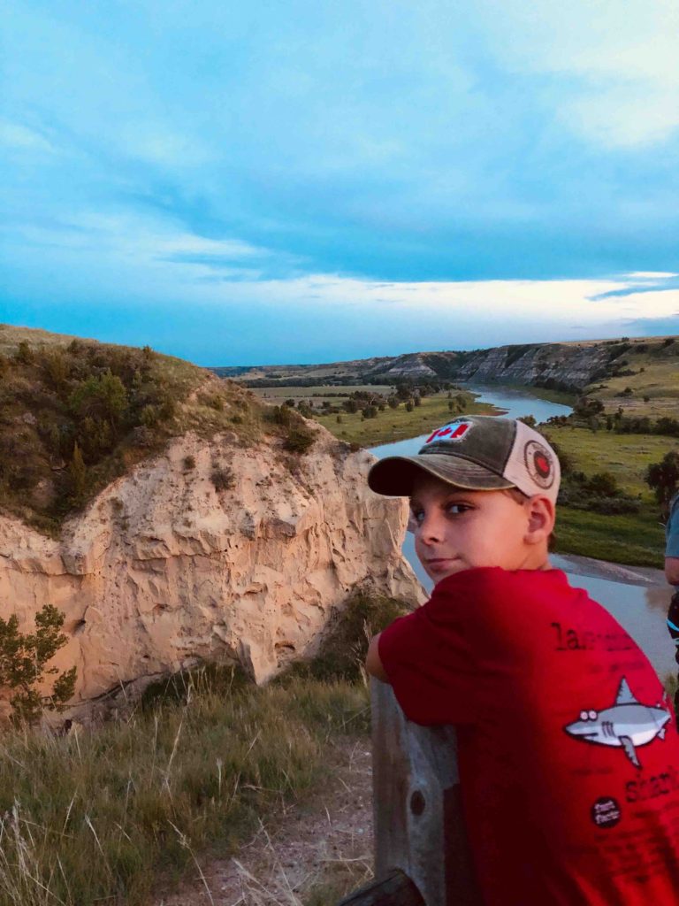
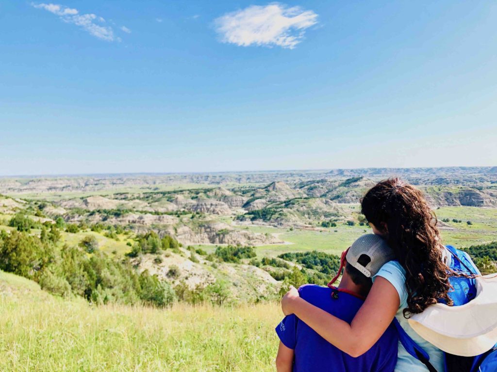
After setting up the trailer and exploring the Little Missouri river behind our campsite, we searched for wildlife on the scenic loop drive. The turnouts in the park were beautiful and we soon spotted a herd of wild horses. The horses were truly magnificent creatures, they were a rainbow of colors, ranging from a midnight black and chestnut brown to a blinding white. We followed them in our car as they made their way down a hill and to a watering hole. We ended our evening with a ranger lead moonlit hike on the Wind Canyon Trail.
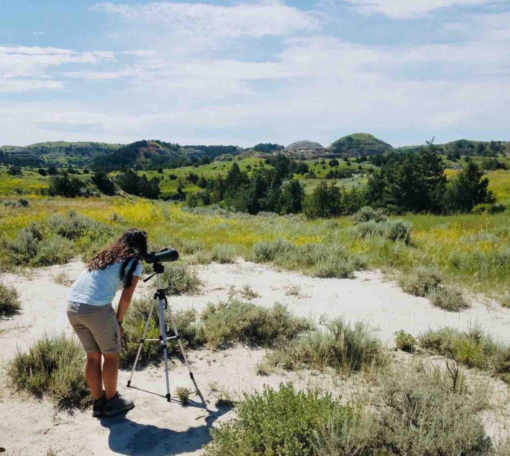
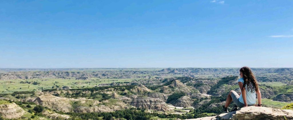
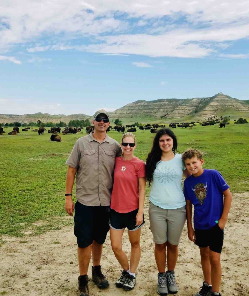
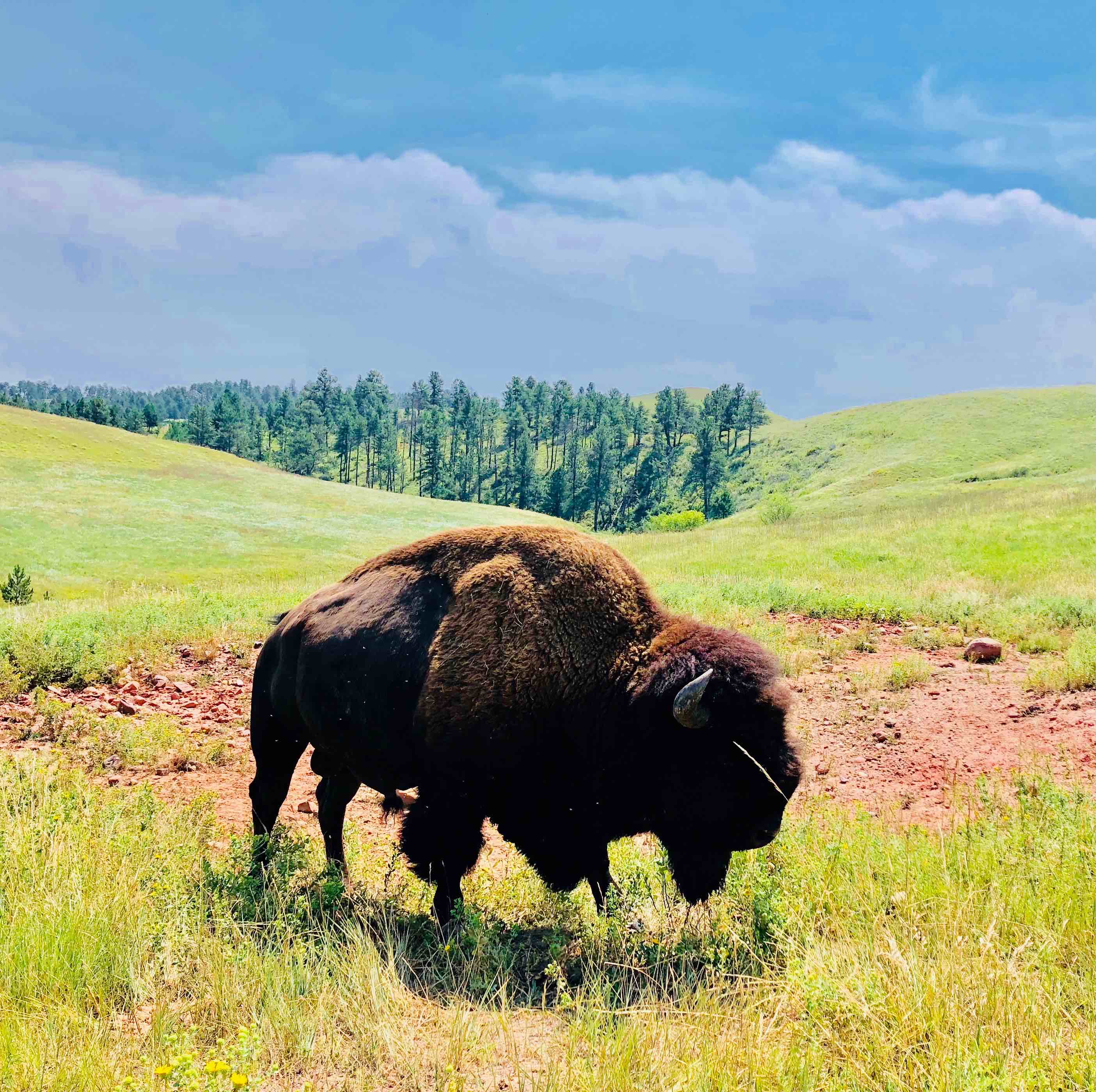
In the morning, we decided to go back to the Scenic Loop Drive to look for bison. We hiked the Buck Hill trail and part of the old east entrance where we spotted a bison and a multitude of prairie dogs. We decided to press down the road to try and find more bison. Just before we got back to our campground, we saw a bison jam (it’s like a traffic jam, just with bison occupying most of the road)! A huge herd of bison was moving through the area. We pulled over and ate our lunch as the bison grazed their lunch in an adjacent field. We finished our trip to Theodore Roosevelt National Park by hiking the Painted Canyon Nature Trail in the rain. It was a beautiful, quiet and wet (it was raining) hike.
Overall, Theodore Roosevelt National Park had great history, hiking and wildlife. The story behind the park and its namesake, President Roosevelt was extremely interesting. The hillsides were full of beautiful green grasses and yellow clover. We were able to spot several wild animals including: wild horses, bison, prairie rattle snakes, frogs, sage grouse, bunnies and bats. The park was not easy to get to but was definitely worth seeing!